We're undergoing a website migration. Please pardon any intermittent outages.
sized-Lithium-map-BLM.jpg
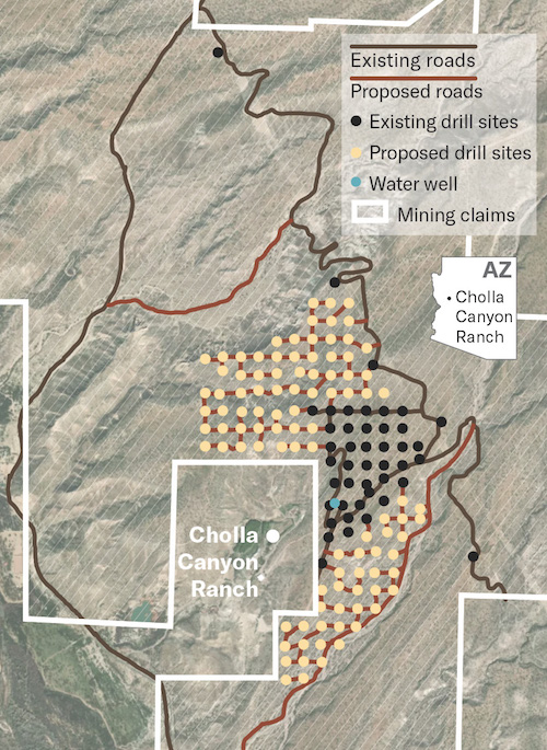
A Bureau of Land Management map shows the completed (black dots) and proposed (light yellow dots) drilling sites surrounding the eastern side of the Cholla Canyon Ranch property. (Bureau of Land Management)